AirNav RadarBox Solutions: NAT Tracks

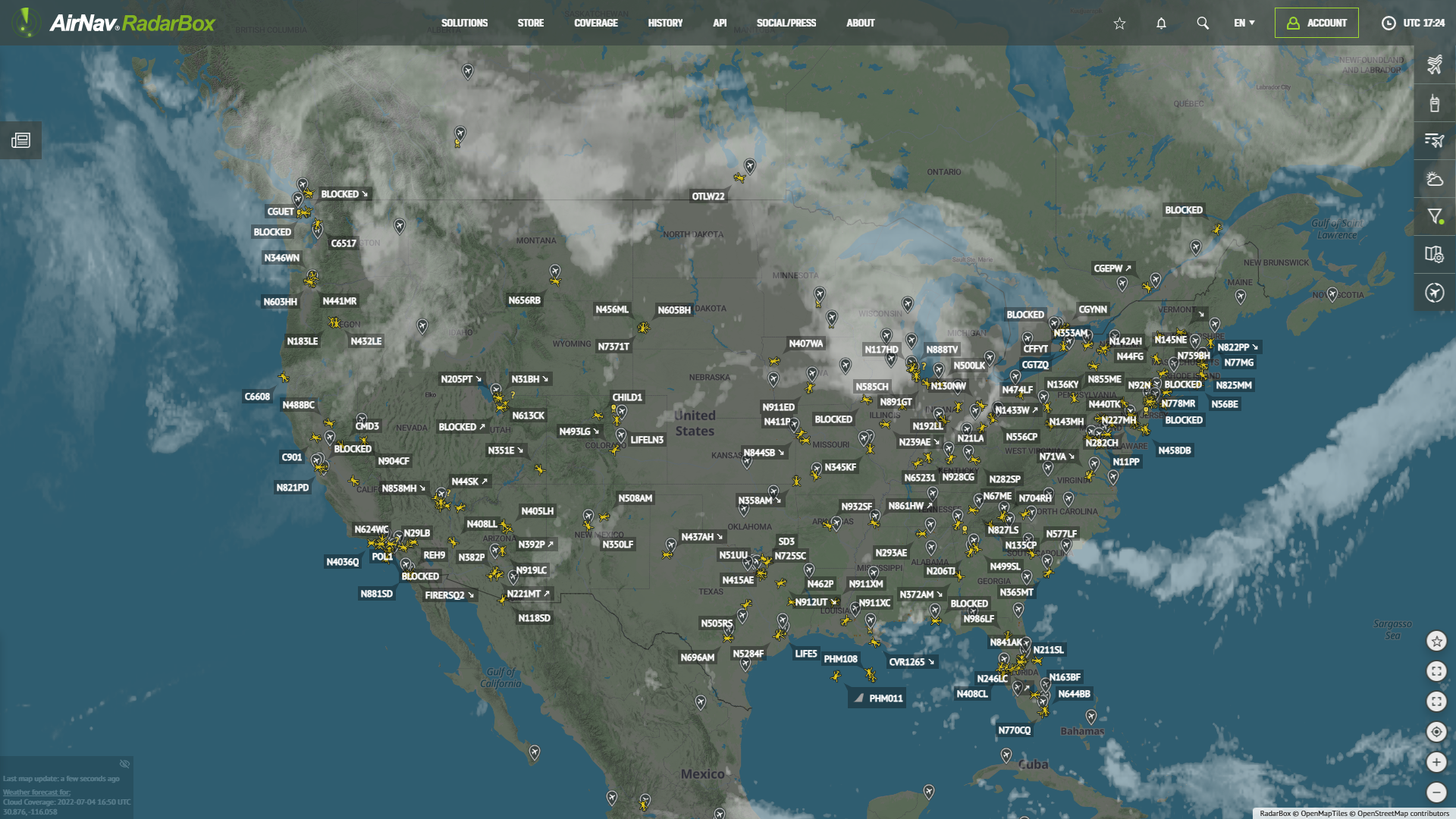
The Image Above: NAT Tracks displayed on RadarBox.com
The week's solution in focus is AirNav's RadarBox NAT tracks. This newly released premium feature is available only on RadarBox business accounts.
NAT (North Atlantic Tracks)
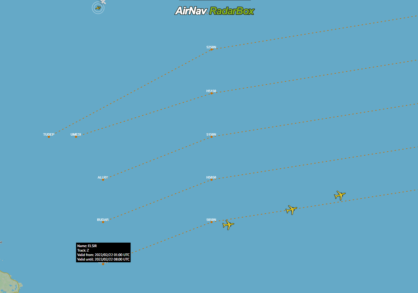
The North Atlantic Tracks or known as NAT, are high-altitude routes across the Atlantic between the west coast of Europe and the east coast of North America. One of the busiest oceanic airspaces in the world.

The Image Above: NAT Tracks displayed on RadarBox.com

The Image Above: NAT Tracks displayed on RadarBox.com
The Image Above: NAT Tracks displayed on RadarBox.com
The Image Above: NAT Tracks displayed on RadarBox.com
The Image Above: NAT Tracks displayed on RadarBox.com
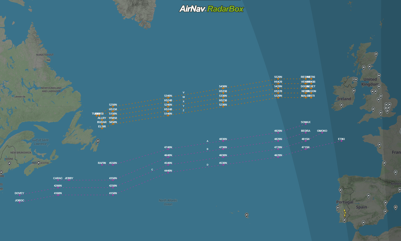
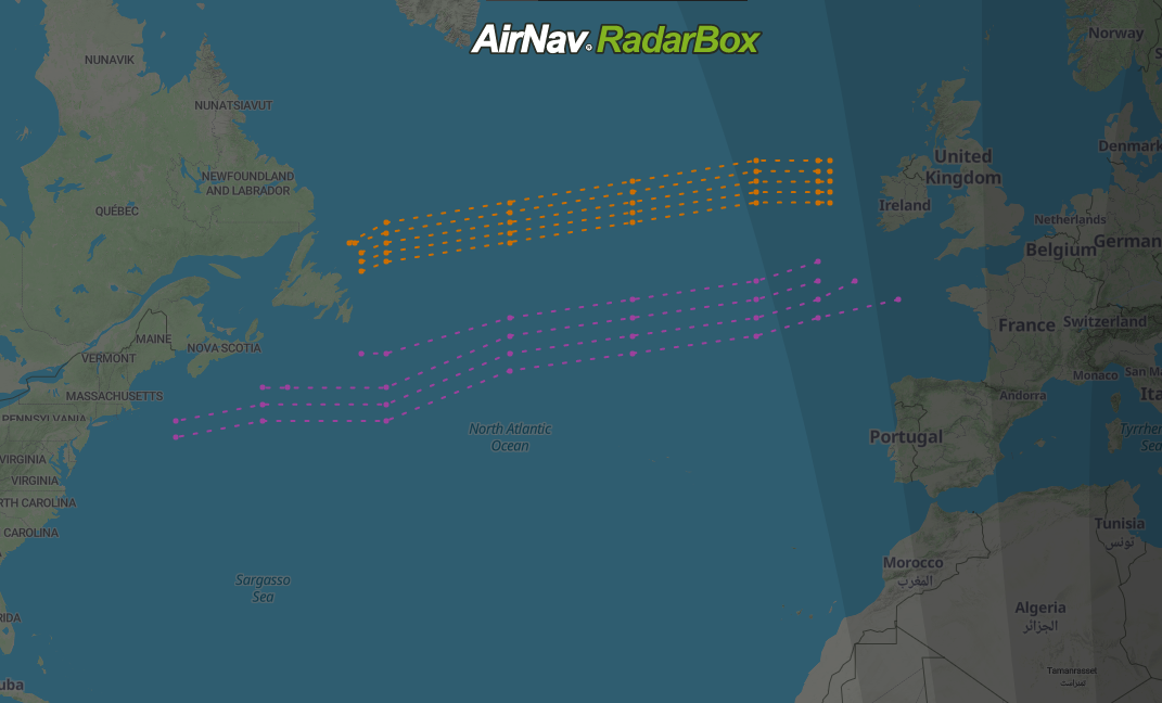
The NAT tracks are divided into two groups: day (purple) and night (orange). The NAT tracks available during the day are valid between 11:30 AM and 7:00 PM (UTC) and are generally used for flights between Europe and North America.
Night NAT tracks are represented graphically with orange color and are valid between 01:00 AM - 08:00 AM (UTC) and are used for flights between North America and Europe. Despite the validity of the tracks, tracks are always available earlier as soon as we have the data and are displayed up to 3 hours after their validity. This may occur because there may be flights that still use these tracks.
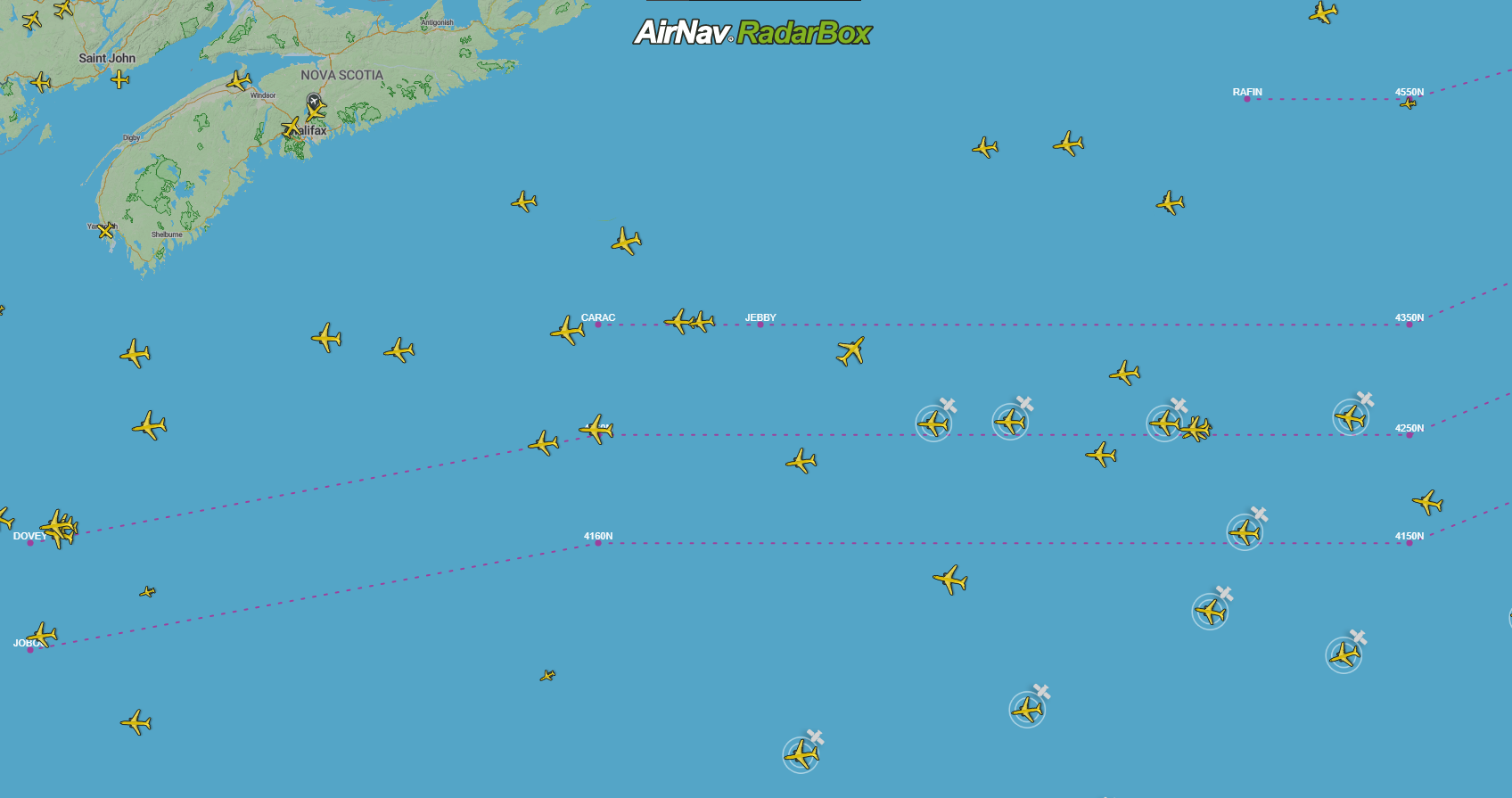
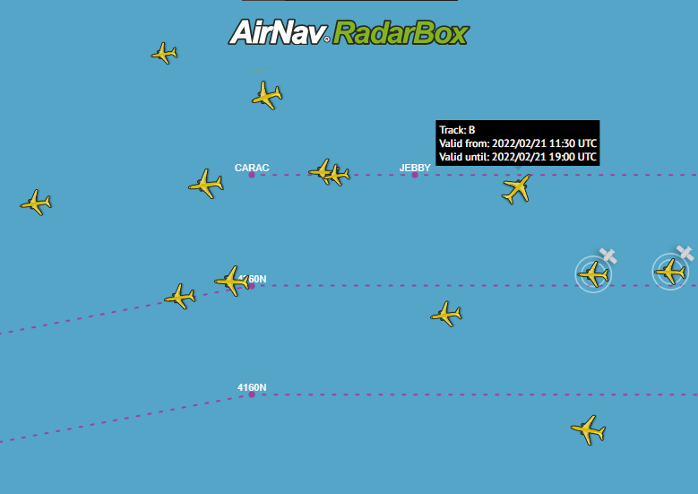
The number of tracks varies according to weather conditions and requirements. Generally, the tracks used between 11:30 - 19:00 (UTC) are identified by a letter in alphabetical order, starting from the letter A, and nocturnal tracks are identified with the letter Z. Each NAT track has checkpoints along its way. Example: MALOT, GISTI, BEXET, DOGAL). The checkpoints are intermediate demonstrate where they are located, for example, 5220N and 4740N (Latitude and longitude). Additionally, you can see the tracks from previous days with the Playback function. NAT Tracks are shown on the flight page of a past flight. NAT tracks are only available for Business users.
Tutorial (RadarBox.com)
To activate NAT tracks is easy; just access RadarBox.com. On the right side of the website, select the fifth item, "Map Options" and "Routes," and select the "NAT" option. Done!
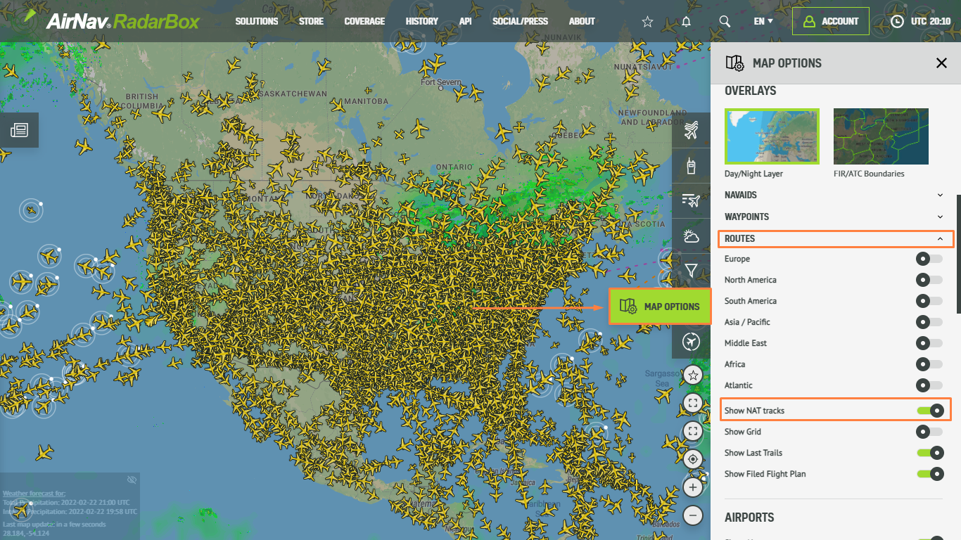
The Image Above: RadarBox.com
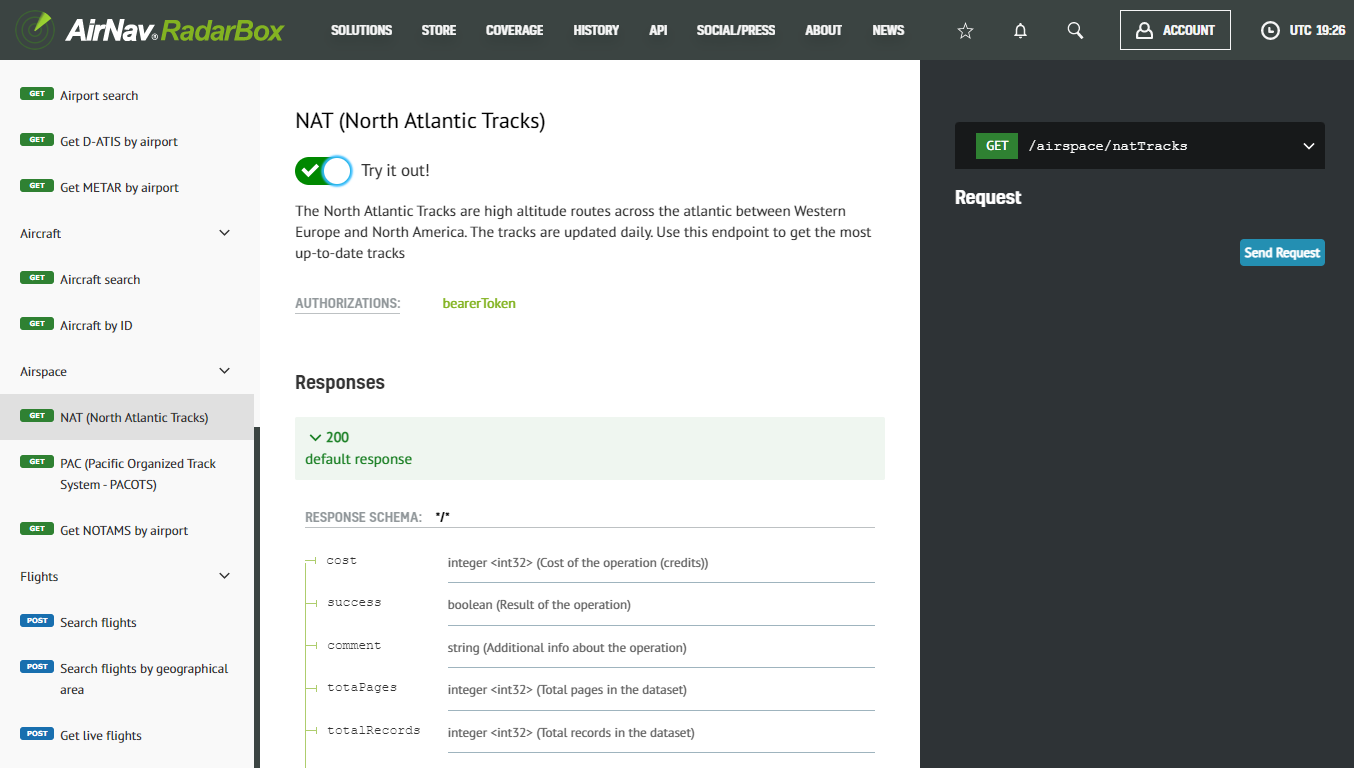
RadarBox On-Demand API
NAT Tracks are also available in the RadarBox On-Demand API. These tracks are updated daily. In the screenshot, we request NAT tracks valid from 11:30 to 19:00 (UTC). Easy, isn't it? Continue reading our blog to learn more!
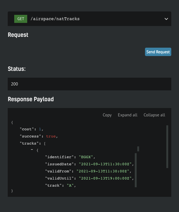
The Image Above: Screenshot of NAT Tracks on the API Documentation page
How to use RadarBox On-Demand API
Getting your free token
You get a free token with your business account, which will give you enough credit to play. You can find yours by navigating to your API Dashboard. Once you have it, open up the API documentation in a new tab so you can keep reading the how-to guide here
Step-by-step guide
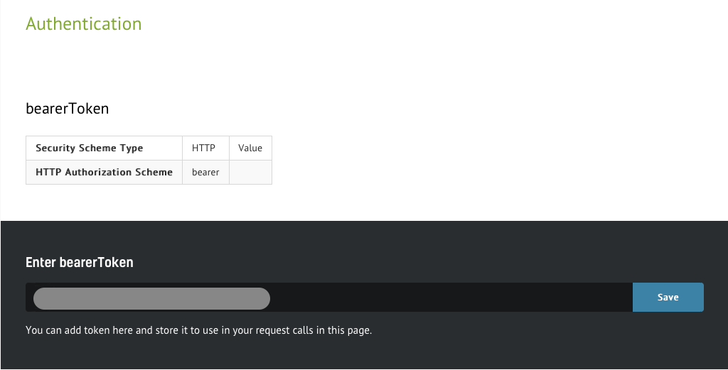
1. Authenticate
The Image Above: Screenshot of Airspace Data from the API Documentation page
The steps below will show how easy it is to interact with the API. On the documentation page, you'll be able to scroll through the specs. Every call needs to be authenticated, so you need to put the token you wish to use in context. Simply insert the token in the designated form and hit "Save" button. From here on, all service calls will be associated to your account.
Select the desired data solution
The Image Above: RadarBox On-Demand Documentation Page
Subscribe now!
To enjoy these features and updates, why not consider subscribing to RadarBox? Click here to subscribe! To get in touch with us, click here to find out today!
READ NEXT...
 79251
79251Tracking Helicopters With RadarBox
Today we'll explore how to filter and track helicopters on RadarBox.com. Read this blog post to learn more...- 52146
Air France Boeing 777 and American Airlines Boeing 737 experienced a near miss over Caribbean
Air France Boeing 777-300 and American Airlines Boeing 737-800 experienced a near miss over the Caribbean Sea. The planes were safely separated after the TCAS got activated. - 30371
AirNav Announces Coronavirus Related Data & Graphics Available
AirNav Systems is providing data COVID-19 air traffic related data for analysis, study and use.