AirNav RadarBox On-Demand API Series: Flight Statistics Part 1
The Image Above: AirNav RadarBox API displayed on the screen
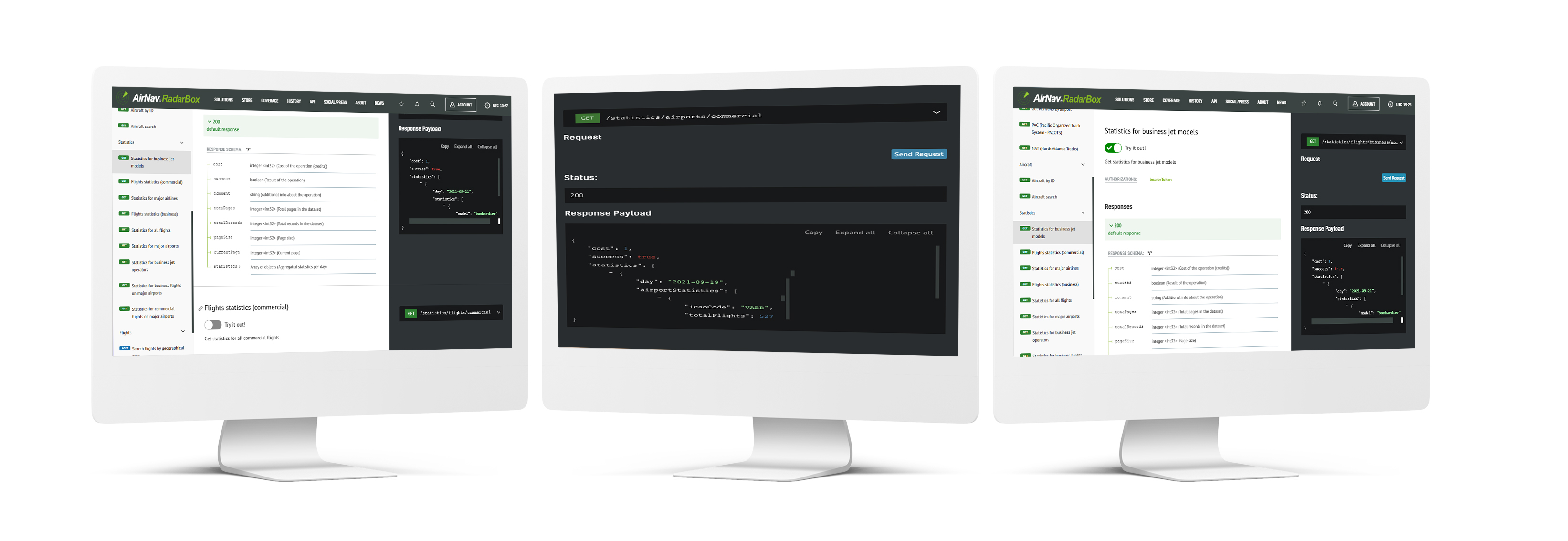
This week's AirNav RadarBox API series blog post focuses on flight statistics, specifically on commercial flight statistics and flight statistics by airport, business jet operators, and business jet models.
To access RadarBox On-Demand API flight statistics solutions, go to Radarbox.com/api/documentation -> "Flight Statistics" and query the data or flight statistics that you wish.
The Image Above: Screenshot of Flight Statistics on the API Documentation page
Our flight statistics come from our ground-based ADS-B and space-based ADS-B, plus 12 different data source types, ensuring the accuracy of our data. Besides our variety of data sources, we also include over 70+ data fields - where you can search and find the information/data according to your needs and demands. Click here to learn more about our data sources.
For more information on documentation, pricing, downloading our client SDK, and data sources, please visit - https://www.radarbox.com/api/documentation
To learn and discover more about our API solutions, visit - https://www.radarbox.com/api
Why do customers love our API Solutions?
- Credit-per-query pricing - Pay only for what you use.
- Developer-Friendly API - Seamless integration into client applications.
- Starts at 10,000 credits/mo. - Affordability with the option to upgrade credits.
- Flight data from 12+ sources - Ensuring accuracy through redundancy.
- 24/7 Client Support - 365 days priority email and phone support.
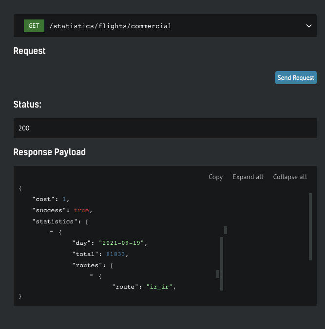
1. Commercial Flight Statistics on September 19, 2021
The Image Above: Screenshot of Flight Statistics on the API Documentation page
RadarBox flight statistics include general commercial flight statistics for the USA, Europe, UK, Italy, China, Japan, Brazil, etc. And, in addition to domestic flight statistics, we also provide commercial flight statistics for international flights from one country to another.
The image above shows a query for the total number of flights on September 19, 2021. The returned response shows 81,833 commercial flights worldwide.
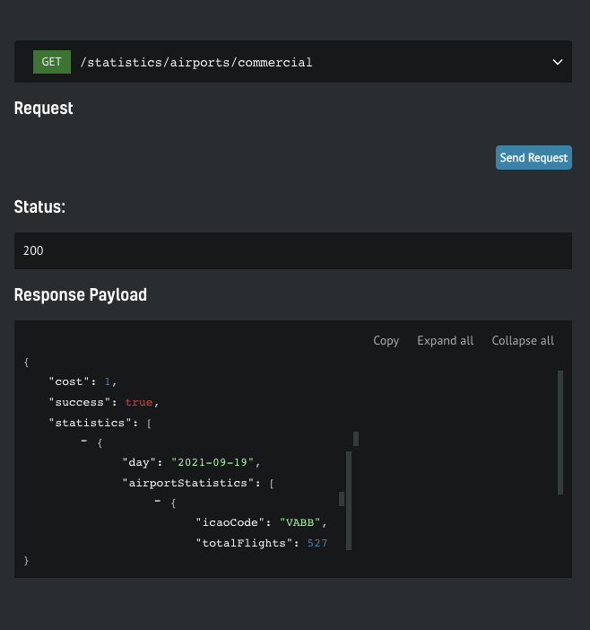
2. Airport Movement Statistics at Chhatrapati Shivaji Maharaj International Airport (BOM/VABB) on September 19, 2021.
The Image Above: Screenshot of Flight Statistics on the API Documentation page
The movement statistics for airports are available for all airports around the world. Flight statistics requests can be made for any date. Taking a look at the query above, for example, on September 19, 527 commercial flights were registered at Mumbai Airport (BOM/VABB), a city located on the west coast of India.
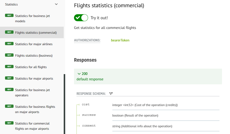
3. Business Jet Operator Statistics (XoJet) on September 19, 2021.
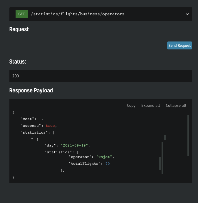
The Image Above: Screenshot of Flight Statistics on the API Documentation page
Under the requested flight statistics for September 19 for business jet operator XoJet, 70 flights were operated by the Florida-based business jet operator. Among the major business jet operators, you can request data from are: Netjets, Executive Jet Management, Gama Aviation, Wheels Up, Delta Private Jet, VistaJet, FlexJet, Jetlinx, Luxaviation, and all other business jet operators around the world.
4. Business Jet Models Statistics (XoJet) on September 19, 2021.
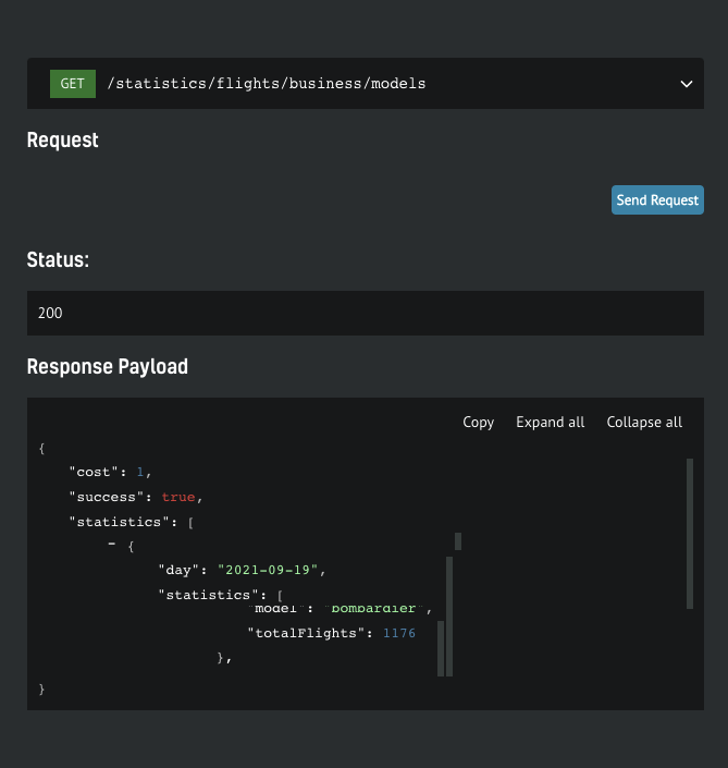
The Image Above: Screenshot of Flight Statistics on the API Documentation page
The data requested for the business jet manufacturer Bombardier for September 19 shows that 1176 aircraft from the Bombardier family flew around the world on that day. These flight statistics are available for major business jet manufacturers such as: Gulfstream, Bombardier, Bombardier, Falcon, Embraer, Cessna, etc.
How to use RadarBox On-Demand API
Getting your free token
You get a free token with your business account, which will give you enough credit to play. You can find yours by navigating to your API Dashboard. Once you have it, open up the API documentation in a new tab so you can keep reading the how-to guide here
Step-by-step guide
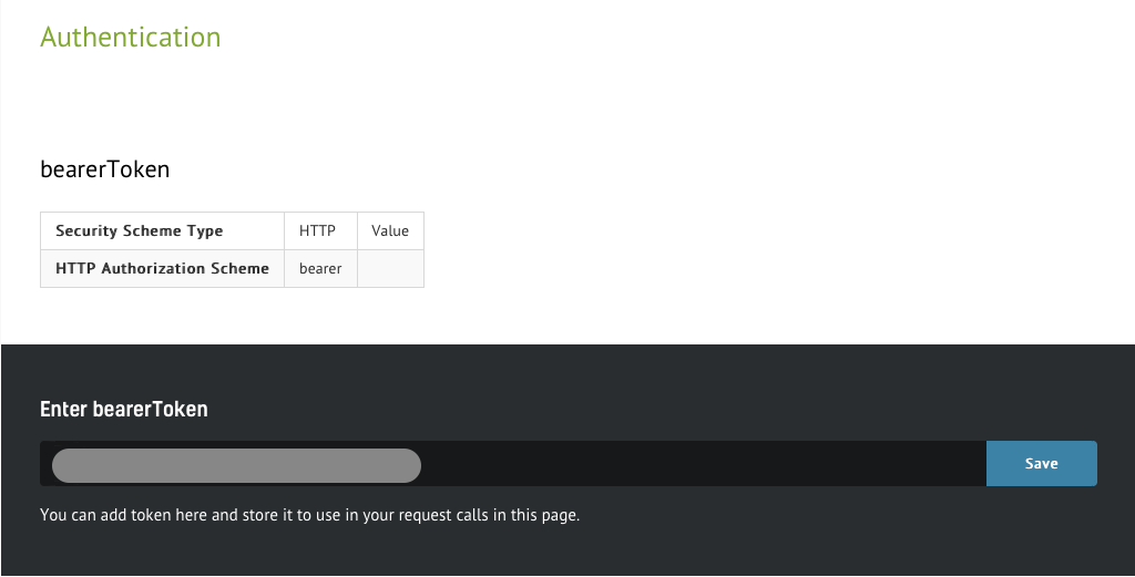
1. Authenticate
The Image Above: Screenshot of Airspace Data from the API Documentation page
The steps below will show how easy it is to interact with the API. On the documentation page, you'll be able to scroll through the specs. Every call needs to be authenticated, so you need to put the token you wish to use in context. Simply insert the token in the designated form and hit "Save" button. From here on, all service calls will be associated to your account.
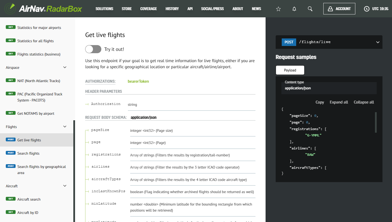
2. View all available services
The Image Above: Screenshot of Airspace Data from the API Documentation page
In the left menu, you'll find a list of the available services. Clicking on each one will take you to the endpoint details, where you can find information such as required parameters and the detailed format of the response.
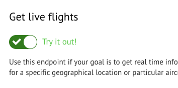
3. Enter testing mode
The Image Above: Screenshot of Airspace Data from the API Documentation page
Click the “Try out” button, which will activate the test mode, and you will be able to submit live requests.

The Image Above: Screenshot of Airspace Data from the API Documentation page
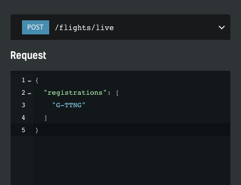
Once you’re in test mode, you will have the request spec on the center column and a text box with the payload of your request on the right. It will be pre-filled with test values which you will need to customize.
4. Sample test case
One of the simplest scenarios is trying to find out what the current position of a specific aircraft is.
The Image Above: Screenshot of Airspace Data from the API Documentation page
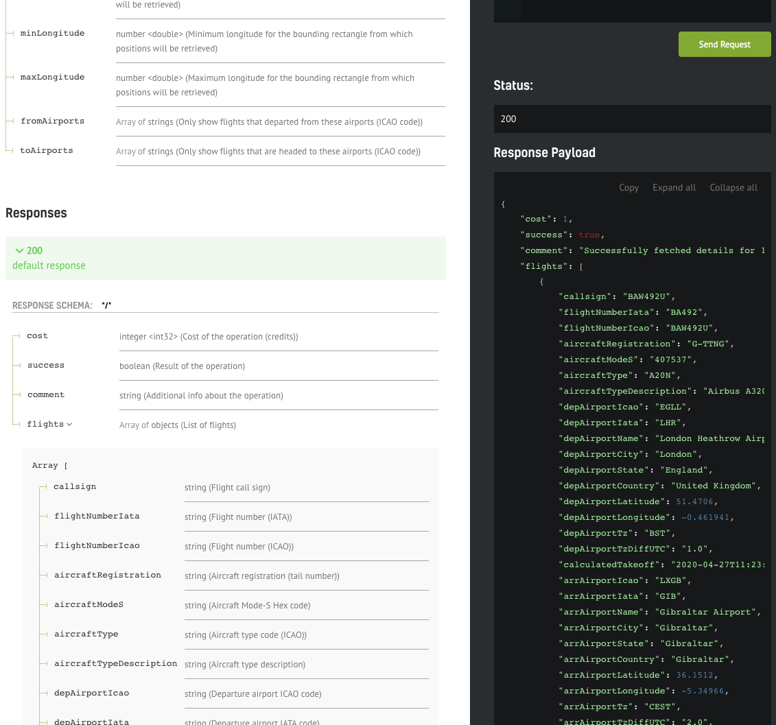
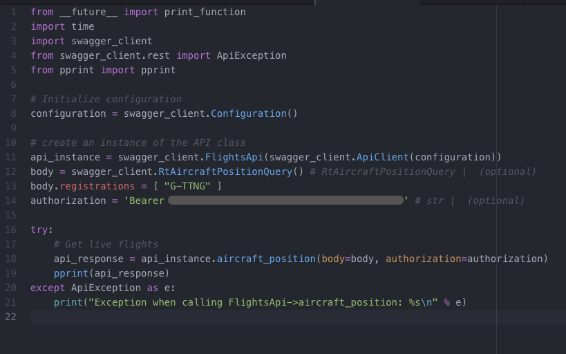
We have edited the sample payload stripping everything except our criteria: get the current position for the aircraft with tail number G-TTNG. After hitting the “Send Request” button, we should get a response within seconds. If all goes smoothly, we should see the status code of the request and the response payload popping up below the initial request.
The Image Above: Screenshot of Airspace Data from the API Documentation page
The documentation of the response fields should be visible on the left of the response payload, making it easy to interpret the data.
Implementing your own client
The interface shown above is great for prototyping your calls, but of course, you still need to implement your own API client. We will show how easy it is to have a full Python API SDK working with only a few lines of code.
.png)
The Image Above: Screenshot of Airspace Data from the API Documentation page
You can also download the web service client in your preferred language or framework - we currently support C#, Java, PHP, Python, Scala, Swift, and Javascript.
Simply select your preferred option from one of the items in the dropdown menu, and the download will start automatically. Once complete, you need to extract the archive and open the contents in your favorite IDE.
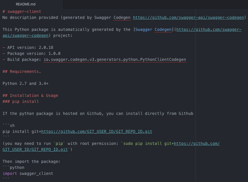
The Image Above: README.md Document
The README.md file contains valuable information and is tailored to the framework we're interested in. In this case, there are instructions on how to setup up your Python environment in order to be able to run the API client smoothly. There are also code snippets that you can copy/paste directly to your code.
The Image Above: README.md Document
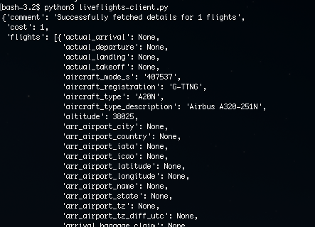
We have copied the snippets from the README file into our own file "liveflights-client.py" and we only needed to add two things: the authentication string (bearer token) and the search parameter (registration "G-TTNG"), same as the call we have previously created in the testing interface.
The Image Above: README.md
After saving the file, we can open up a terminal and use Python to run the client we have just implemented.
What differentiates us from our competitors?
“What differentiates AirNav Radarbox from its competition is what we call AirNav's 3 F's. Flexibility in dealing with each of our customers' requirements. Building Feature-rich and Future-ready products, while focusing on customer satisfaction.” - Andre Brandao, CEO of AirNav Systems.
Customizability means that all solutions are tailored to the client's specific requirements. Our seamless integration into existing client applications and platforms through the offering of ADS-B, FAA SWIM, Oceanic, MLAT, Satellite ADS-C, HFDL, ADS-C, Satellite ADS-B to ensure complete and accurate data means we can offer a lot at relative ease.
Through our offering of multiple data formats such as JSON, XML, CSV, KML, ESRI, and others, we also offer more volume of data for less, which is what makes us stand out from the rest.
Finally, we have 24/7 around-the-clock customer support to help you with any issues you have as well as picking the right package for you.
So don't delay. Why don't you look more into what we can offer you here at AirNav RadarBox? To get in touch with us, click here to find out today!
READ NEXT...
 76960
76960Tracking Helicopters With RadarBox
Today we'll explore how to filter and track helicopters on RadarBox.com. Read this blog post to learn more...- 30241
AirNav Announces Coronavirus Related Data & Graphics Available
AirNav Systems is providing data COVID-19 air traffic related data for analysis, study and use.  21400
21400Replay Past Flights with Playback
AirNav RadarBox officially launches the playback function on RadarBox.com, allowing users to replay the air traffic for a specific date and time in the past, within a 365-day period. Read our blog post to learn more about this feature.