AirNav RadarBox Announces Father's Day Sale - Get 25% off ALL Subscriptions!

AirNav RadarBox is excited to announce its next sale, as we approach Father's Day. Get 25% off ALL subscriptions when you use the code 'DAD25' in order to get a very different and unique gift to show your appreciation to your father!
This means that you can get the following price for the different subscription models that we offer to our customers:
- Spotter - Originally $24.50 per year - $18.38 per year after discount.
- Pilot - Originally $79.50 per year - $59.63 per year after discount.
- Business - Originally $399.50 per year - $299.63 per year after discount.
By subscribing annually also, you get an extra 16% off, meaning that you will save more money in the long run on top of the discount that we are running currently!
We have a series of unique features that we wish to showcase to you as well, in order to show you what you would get for your money too!
Aircraft Utilization Statistics & Airport Heat Maps
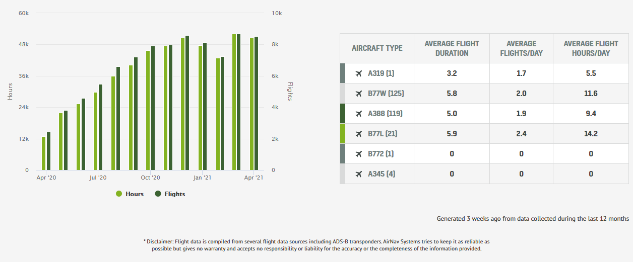
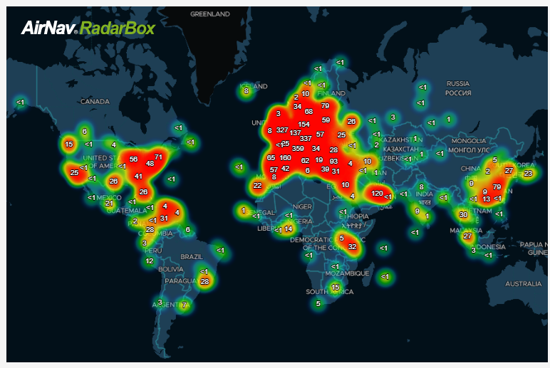
The Images Above: Aircraft Utilization Statistics of Emirates and an Airport Heat Map for Amsterdam Schiphol Airport.
Aircraft Utilization Statistics show the monthly flight time and the total number of flights that an aircraft has taken, with users being able to view figures with various metrics such as the average flight duration or the total distance flown in the past 12 months and the monthly average too.
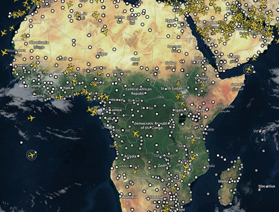
Airport Heat Maps convert the dry and drab route statistics into informative visualizations, where it displays the frequency of flights to different airports or cities from a particular originating airport.
Air Traffic Flow Statistics
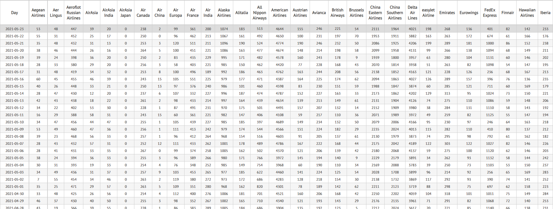
The Image Above: Air Traffic Flow statistics for several airlines around the world. Click here to access that information.
The Air Traffic Flow Statistics page contains a large volume of flight data from flights tracked daily by ourselves here at AirNav RadarBox.
The stats currently display data from the last six months and can be filtered into the following categories:
- Commercial Airlines
- Business Jets
- Commercial Airports
- Business Operators
- By Route
Such information can be downloaded in a CSV format for free, non-commercial use.
VHF AirBand Radio
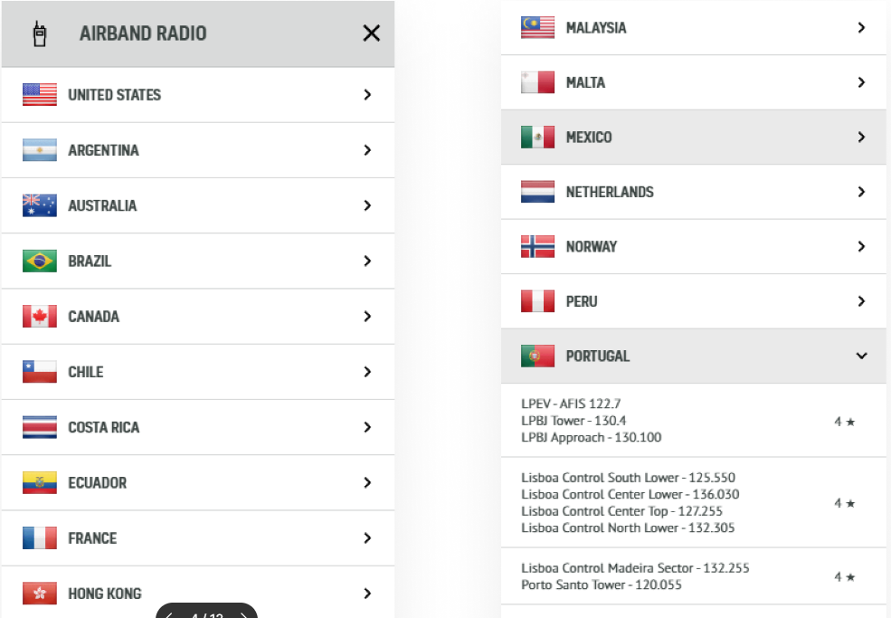
The Image Above: Some of the ATC feeds that you can listen to when using AirNav RadarBox.
VHF AirBand Radio is another exciting feature within AirNav RadarBox where you can listen to over 40 Air Traffic Control feeds from 21 countries around the world.
You can listen to stations from the likes of the United States, all of the way to unique countries such as Hong Kong, Iraq, Japan, Malaysia, and others!
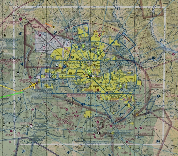
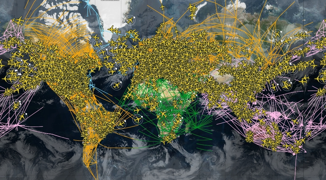
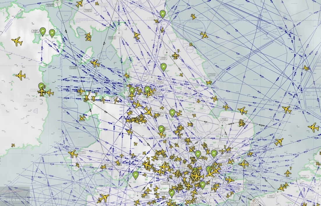
Routes, SkyVector Map & NavAids
The Image Above: NavAids being displayed on the RadarBox map view.
The Image Above: A view of the SkyVector VFR Map on RadarBox.
The Image Above: You can see diagrams of the routes being taken out by every flight in the skies.
The Image Above: A view of the SkyVector HI Map
The Routes, also known as "highways in the sky", show the various fixed tracks and routes that flights fly on, with each geographic area having its own color-coded routes for clear distinctions between continents.
SkyVector VFR highlights an aeronautical chart offering excellent navigational reference for pilots and crews to use during flight planning and operations.
NavAids display radio beacons that help pilots navigate while flying, with users being able to turn them on for specific geographic areas too.
Finally, the Waypoints are represented as small pink circles on the RadarBox map and can also be turned on for specific geographic areas. RadarBox currently displays NavAids and Waypoints over Europe, Asia, Africa, the Middle East, North & South America, and over the Pacific & Atlantic oceans.
Fleet Tracker & Airport View
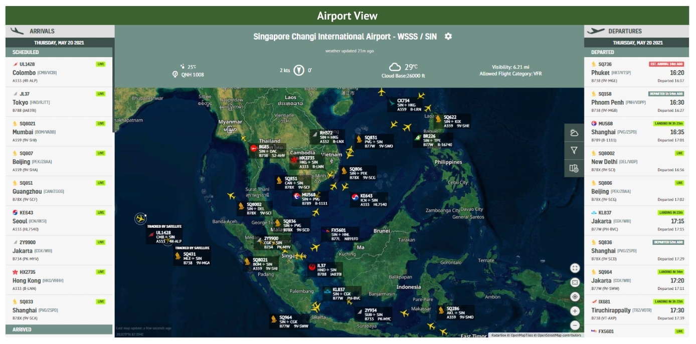
The Image Above: The Airport View being used on Singapore Changi International Airport
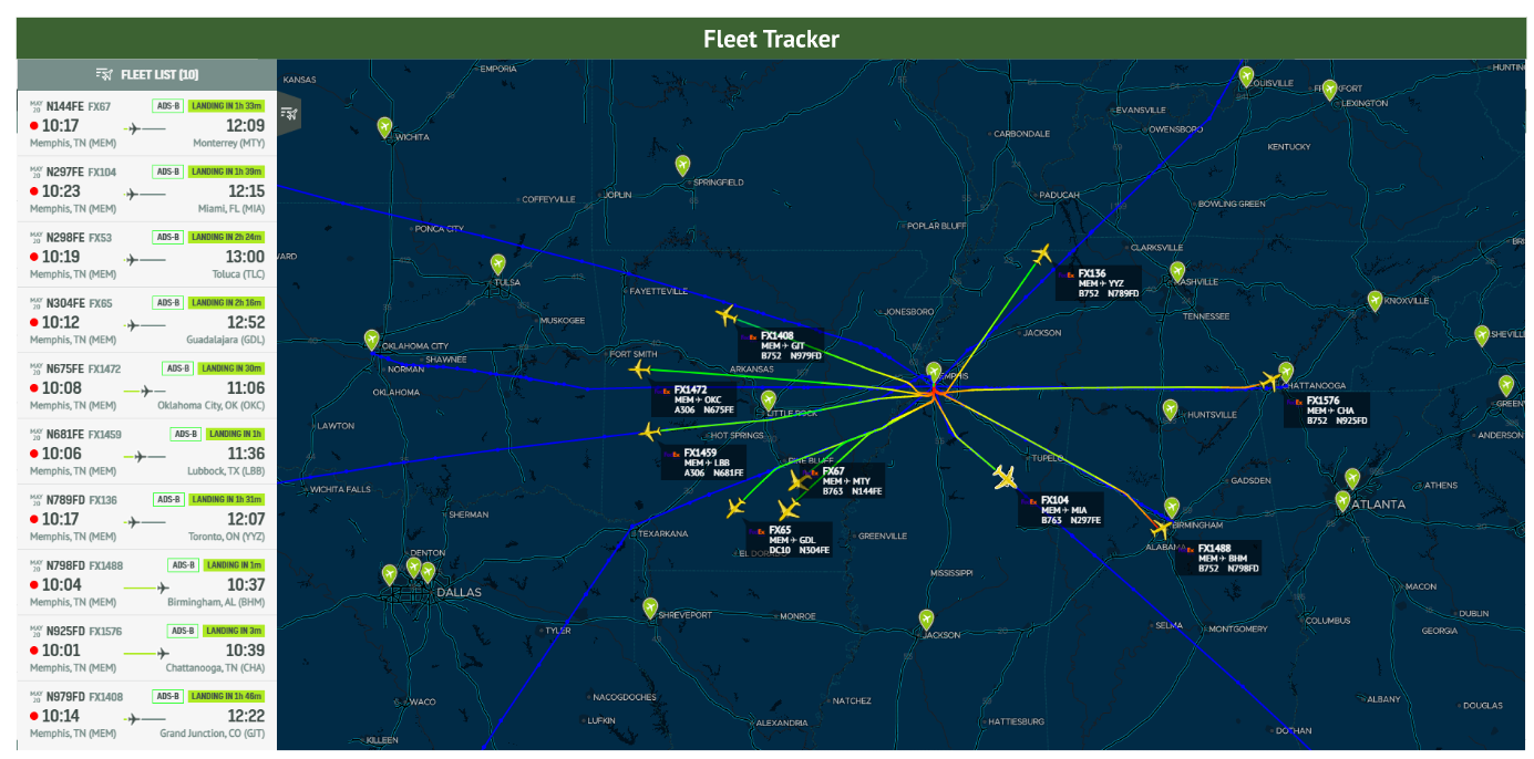
The Image Above: Fleet Tracker is used to track just FedEx flights only with them originating out of Memphis.
The Airport View tool displays the live inbound and outbound flight traffic of a single airport within a single window, offering excellent sources of secondary tracking elements for Air Traffic Controllers and plane spotters.
Weather conditions such as wind speed & direction, visibility, pressure, and cloud base can be viewed.
AirNav's Fleet Tracker is an all-in-one solution designed for fleet managers & owners to monitor and better manage their fleet of aircraft. In addition to viewing all active flights and statuses, fleet managers can view flight history for up to 365 days.
Advanced Weather Layers
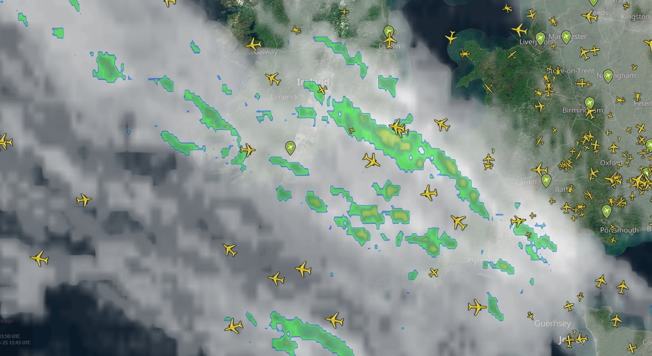
The Image Above: Cloud coverage is one of the many types of Advanced weather layers that we offer.
The 8 weather layers on RadarBox display different aspects of the weather. You can see the following things:
- North American Radar - Precipitation intensity over USA, Canada & Mexico.
- Cloud Coverage - Global infrared satellite imagery of cloud coverage.
- Intense Precipitation - Rate of precipitation forecast based on the GFS model.
- Wind Barbs - Forecast of wind direction and velocity at various altitudes.
- Significant Weather - Displays important meteorological phenomena for FL range 250-630
- AIRMETS & SIGMETS - Describes weather conditions that may affect aircraft safety.
This will better enhance the user experience in better determining whether an aircraft could potentially divert, declare an emergency, and more.
With that in mind, those are some of the many features that we offer here at RadarBox!
Click here to subscribe and start your journey with us today!
READ NEXT...
 14601
14601The King's Coronation: Tracking The Red Arrows on RadarBox.com!
Ahead of the King's Coronation on Saturday in the UK, find out how you can track the Red Arrows on RadarBox.com. 4857
4857AirNav RadarBox Launches Discord Server
AirNav RadarBox is announcing the launch of its latest social media channel launch, being its own Discord server! 4740
4740What's Unique About AirNav RadarBox?
Here at AirNav RadarBox, we have a series of different features that make us stand out from the rest. This post will go over some of those features.