API Series: Airport & Aircraft Data
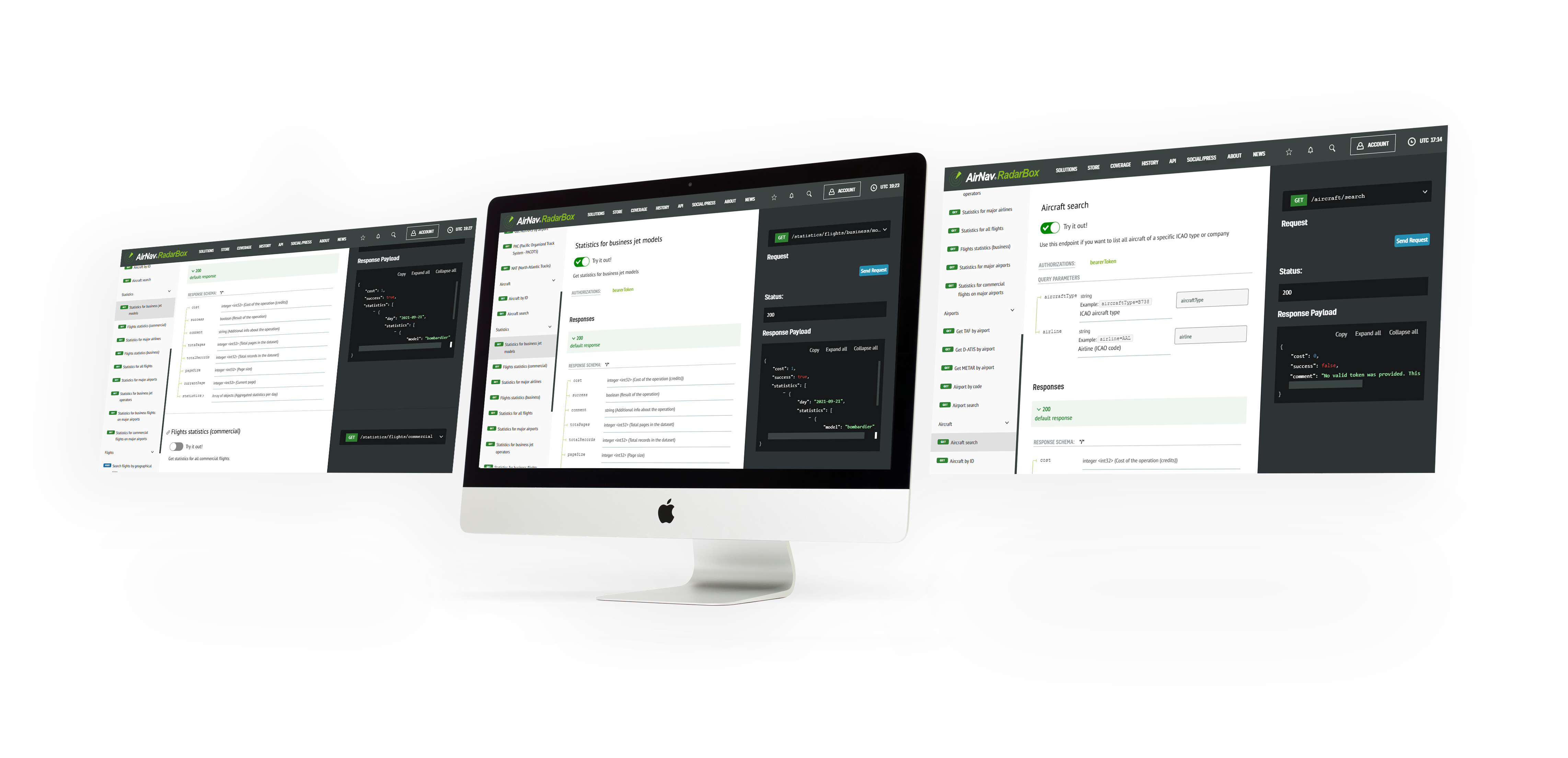
The Image Above: AirNav RadarBox API displayed on the screen
AirNav Radarbox's On-Demand API is our credit-per-query API solution that allows client applications access to real-time and historical flight data on an as-needed basis. Real-time data is aggregated by AirNav’s ground and satellite-based ADS-B network and is delivered via a secure TCP web socket connection, while historic flight tracking data is made available via a download link. This model works on a pay-as-you-go basis and is offered at affordable prices.
Currently, five types of data categories are offered:
1 - Airspace (Notam by airport, NAT, PAC)
2 - Flights (Live flights, search flights, flight by geographical area)
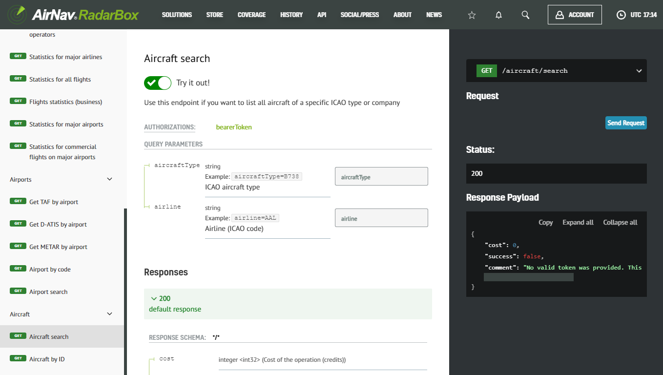
3 - Aircraft (Aircraft search & aircraft search by ID)
4 - Airports (METAR & TAF by airport, airport search, airport code, and D-ATIS by airport)
5 - Flight statistics (Business & Commercial Flight Statistics, Business airports, etc).
The RadarBox On-Demand (ODAPI) client is compatible with 15 frameworks, including Python, Ruby, Scala, Kotlin-client, JavaScript, Typescript, C#, Java, Swift, R, Go, and PHP.
Concluding our series focusing on AirNav RadarBox's On-Demand or ODAPI, this week, we'd like to highlight two categories of data: aircraft and airport data, - used daily by airports, operators & aircraft owners worldwide.
The Image Above: Screenshot of Aircraft & Airport Data on the API Documentation page
To access the RadarBox On-Demand API, visit Radarbox.com/api/documentation -> "Aircraft & Airport Data" and query the data or flight statistics you need.
We also provide 100+ data fields - where you can search. AirNav RadarBox aircraft & airport data come from 14 different data sources, ensuring the precision of our flight data.
Why do customers love our API Solutions?
- Credit-per-query pricing - Pay only for what you use.
- Developer-Friendly API - Seamless integration into client applications.
- Flight data from 14 sources - Ensuring accuracy through redundancy.
- 24/7 Client Support - 365 days priority email and phone support.
For more information on documentation, pricing, downloading our client SDK, and data sources, please visit - https://www.radarbox.com/api/documentation
To learn and discover more about our API solutions, visit - https://www.radarbox.com/api
Aircraft data
In this data category, you'll find all of the data related to aircraft, such as tail number, ICAO type, the owner (company), serial number, or when the aircraft performed its first flight. Plus, statistics of flight hours and most used airports by a specific aircraft.
1. Aircraft by airline
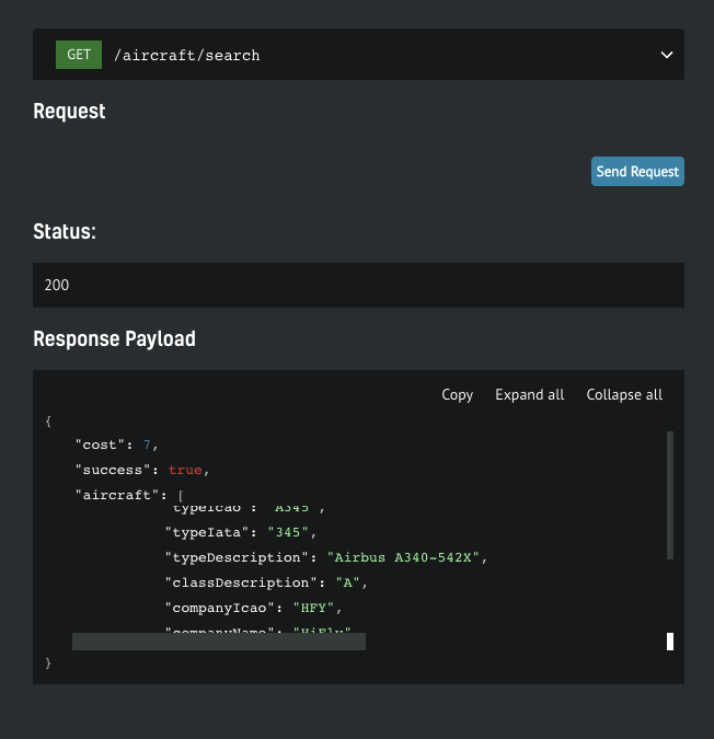
The Image Above: Screenshot of Aircraft Data (By airline) on API Documentation page
You can search for aircraft data by tail number, ICAO company, or airline ICAO in this data option. The screenshot above shows that a data request was made for the entire HiFly (HFY) fleet, and from this, you can see that one of the Lisbon-based company's Airbus A340-542X was displayed in the response payload.
2. Aircraft by ID
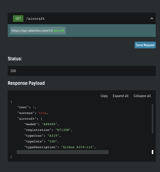
The Image Above: Screenshot of Aircraft Data (By ID - Registration) on API Documentation page
In the aircraft search by ID option, you'll find details and data for a particular aircraft by MODE-S hex code, tail number, or registration. In the example above, aircraft data by ID (registration) was requested for Airbus A319-112 with registration N173UW with IATA code 32D, which means the aircraft is equipped with sharklets.
Airports
Using this endpoint, you'll be able to obtain details of some specific airports (by ICAO or IATA code) as well as search by country, city, or latitude/longitude, and access to static information such as codes, cities, countries, elevation, time zone, and list of runways as well as real-time information (e.g runway in use; recent takeoff/landing statistics)
1. D-ATIS by airport
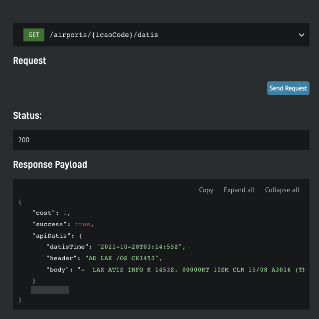
The Image Above: Screenshot of D-ATIS data on API Documentation page
D-ATIS (Data Link-Automatic Terminal Information Services) is a service that continuously broadcasts aeronautical information around the airport (Terminal areas, surroundings, etc). This data option is designed to find the latest information for a specific airport anywhere in the world. D-ATIS is the transcription of information from a specific airport into text form.
As can be seen from the Response Payload, D-ATIS data was requested for Los Angeles International Airport (LAX) to 2021-10-28 (14:55Z), located in California and one of the busiest airports in the USA. In the "heady" and "body" items, the D-ATIS information is displayed in text form.
2. Airport by code
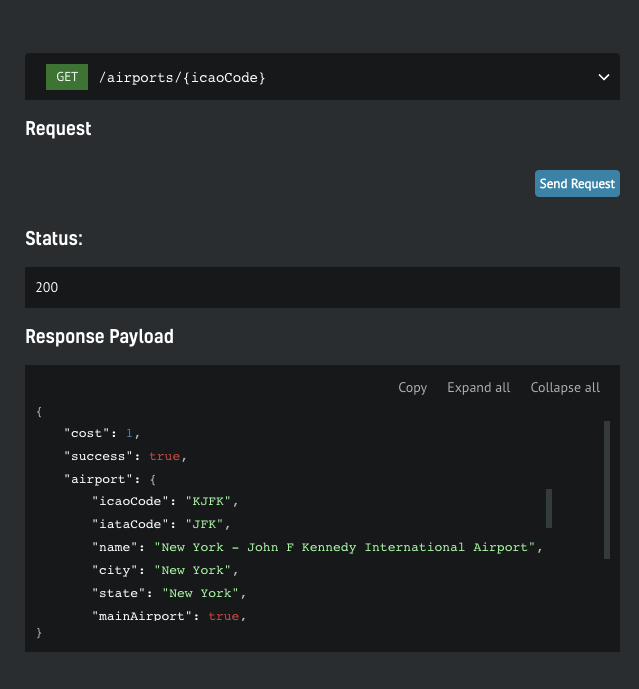
The Image Above: Screenshot of Airport Data on API Documentation page
In this search field, you can find any airport by ICAO or IATA code. Just type in the ICAO or ICAO code, e.g. the ICAO code for John F. Kennedy Airport is KFJK and the IATA code: JFK.
3. Airport search
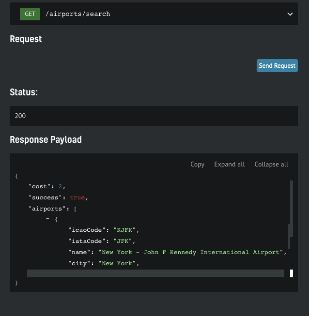
The Image Above: Screenshot of Airport Data on API Documentation page
In the same way as airport by code, you can search for which and how many airports exist in a particular city. In New York, for example, there are three airports:
- John F. Kennedy International Airport (JFK)
- LaGuardia Airport (LGA)
- Newark International Airport (EWR)
4. METAR by airport
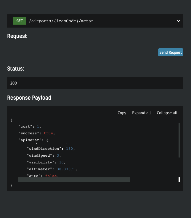
The Image Above: Screenshot of METAR data on API Documentation page
METARs (Meteorological Aerodrome Reports) provide a report of the current weather conditions in a specific airport, with information such as wind direction & speed, visibility, altimeter, etc.
5. TAF by airport
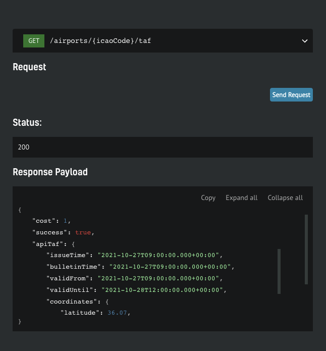
The Image Above: Screenshot of TAF Data on API Documentation page
TAF (Terminal Aerodrome Forecast) is a weather forecast data service provided by airports to serve the local air traffic, and are updated several times throughout the day to ensure that pilots and aircraft operators have access to the most up-to-date information. You can get this data by entering the IATA and ICAO codes to get up-to-date weather information at a particular airport.
How to use RadarBox On-Demand API
Getting your free token
You get a free token with your business account, which will give you enough credit to play. You can find yours by navigating to your API Dashboard. Once you have it, open up the API documentation in a new tab so you can keep reading the how-to guide here
Step-by-step guide
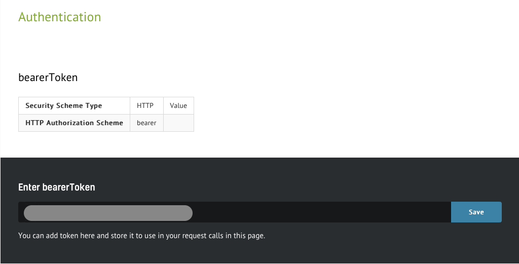
1. Authenticate
The Image Above: Screenshot of Airspace Data from the API Documentation page
The steps below will show how easy it is to interact with the API. On the documentation page, you'll be able to scroll through the specs. Every call needs to be authenticated, so you need to put the token you wish to use in context. Simply insert the token in the designated form and hit "Save" button. From here on, all service calls will be associated with your account.
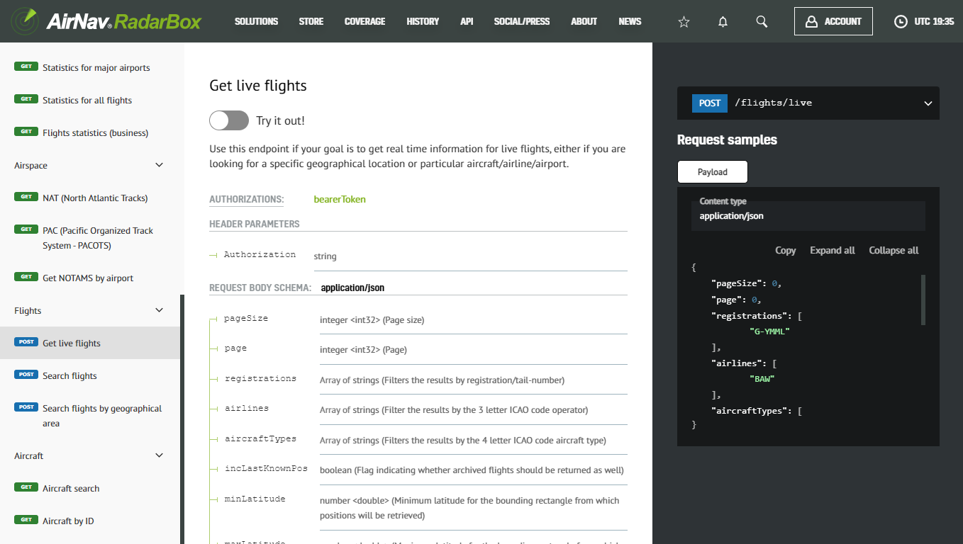
2. View all available services
The Image Above: Screenshot of Airspace Data from the API Documentation page
On the left menu, you will find a list of the available services. Clicking on each one will take you to the endpoint details, where you can find information such as required parameters and the detailed format of the response.
3. Enter testing mode
The Image Above: Screenshot of Airspace Data from the API Documentation page
By clicking the “Try it out” button, the test mode is activated. This is when live requests can be submitted.

The Image Above: Screenshot of Airspace Data from the API Documentation page
Once you’re in test mode, you will have the request spec on the center column and a text box with the payload of your request on the right. It will be pre-filled with test values which you will need to customize.
4. Sample test case
One of the simplest scenarios is to find out what the current position of a specific aircraft is.
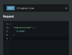
The Image Above: Screenshot of Airspace Data from the API Documentation page
We have edited the sample payload stripping everything except our criteria: get the current position for the aircraft with tail number G-TTNG. After hitting the “Send Request” button, we should get a response within seconds. If all goes smoothly, we should see the status code of the request and the response payload popping up below the initial request.
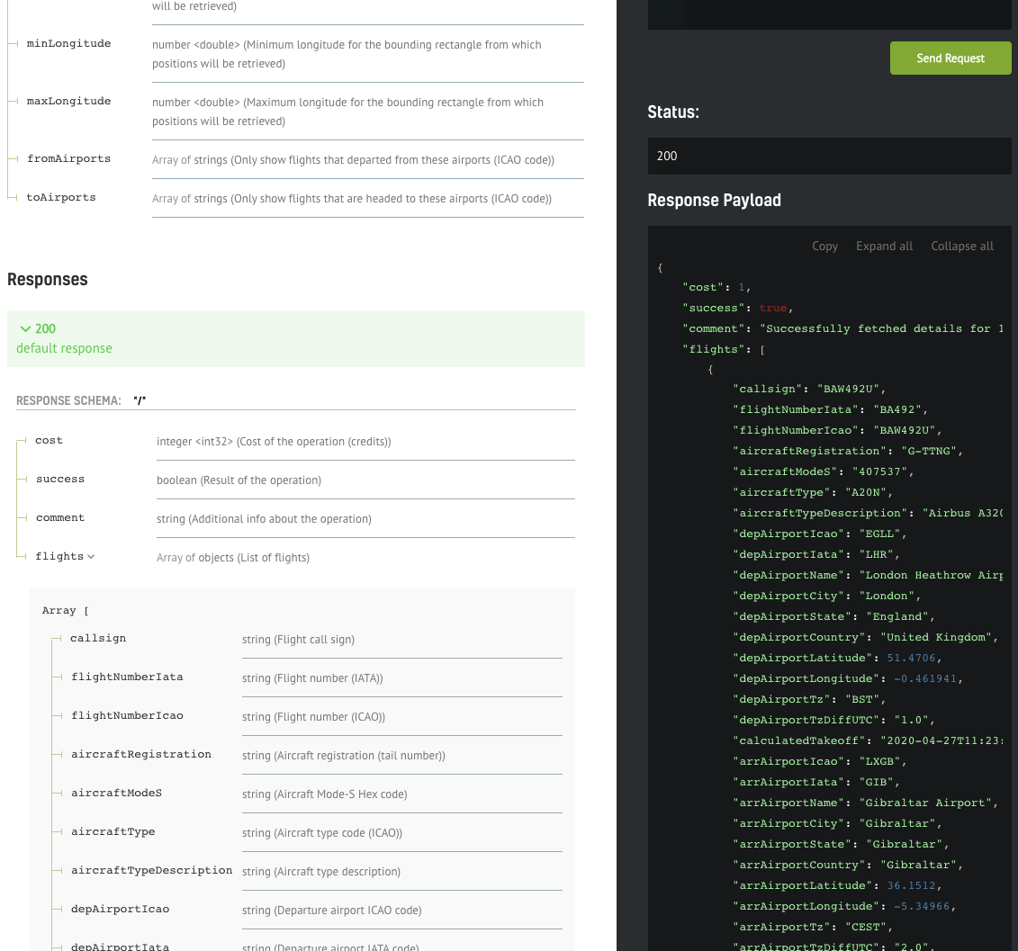
The Image Above: Screenshot of Airspace Data from the API Documentation page
The documentation of the response fields should be visible on the left of the response payload, making it easy to interpret the data.
Implementing your own client
The interface shown above is great for prototyping your calls, but of course, you still need to implement your own API client. We will show how easy it is to have a full Python API SDK working with only a few lines of code.
.png)
The Image Above: Screenshot of Airspace Data from the API Documentation page
You can download the web service client in your favorite language/framework - we currently support the most popular ones such as C#, Java, PHP, Python, Scala, Swift, and Javascript.
Simply select your option from one of the items in the dropdown menu, and the download will start automatically. Once complete, you need to extract the archive and open the contents in your favorite IDE.
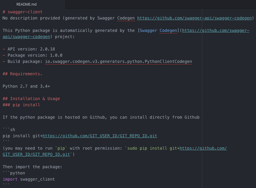
The Image Above: README.md Document
The README.md file contains valuable information and is tailored to the framework we're interested in. In this case, there are instructions on how to setup up your Python environment in order to be able to run the API client smoothly. There are also code snippets that you can copy/paste directly to your code.
The Image Above: README.md Document
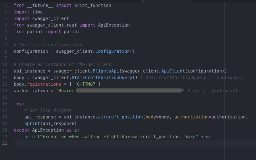
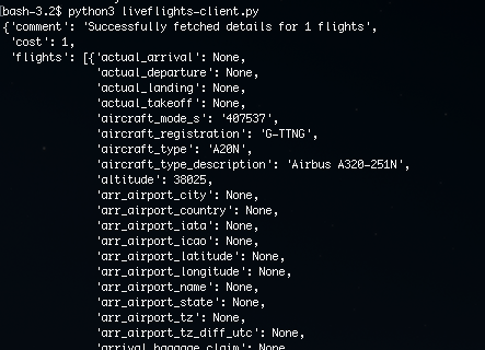
We have copied the snippets from the README file into our own file "liveflights-client.py" and we only needed to add two things: the authentication string (bearer token) and the search parameter (registration "G-TTNG"), same as the call we have previously created in the testing interface.
The Image Above: README.md
After saving the file, we can open up a terminal and use Python to run the client we have just implemented.
What differentiates us from our competitors?
“What differentiates AirNav Radarbox from its competition is what we call AirNav's 3 F's. Flexibility in dealing with each of our customers' requirements. Building Feature-rich and Future-ready products, while focusing on customer satisfaction.” - Andre Brandao, CEO of AirNav Systems.
We offer our data in multiple formats such as JSON, XML, CSV, KML, etc. and our top-notch customer support works 24/7 x 365. So check out our pricing plans, we offer volume-based discounts for larger data volumes. If you'd like to discuss a customized plan for your team or application, get in touch with us today! Click here to get in touch now!
READ NEXT...
 78225
78225Tracking Helicopters With RadarBox
Today we'll explore how to filter and track helicopters on RadarBox.com. Read this blog post to learn more...- 30326
AirNav Announces Coronavirus Related Data & Graphics Available
AirNav Systems is providing data COVID-19 air traffic related data for analysis, study and use. 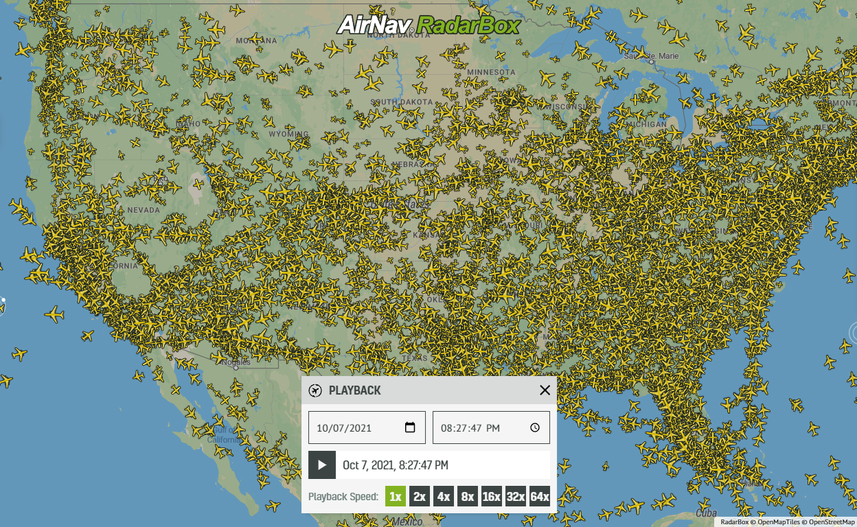 21713
21713Replay Past Flights with Playback
AirNav RadarBox officially launches the playback function on RadarBox.com, allowing users to replay the air traffic for a specific date and time in the past, within a 365-day period. Read our blog post to learn more about this feature.