AirNav RadarBox Maps: Terrain & Classic
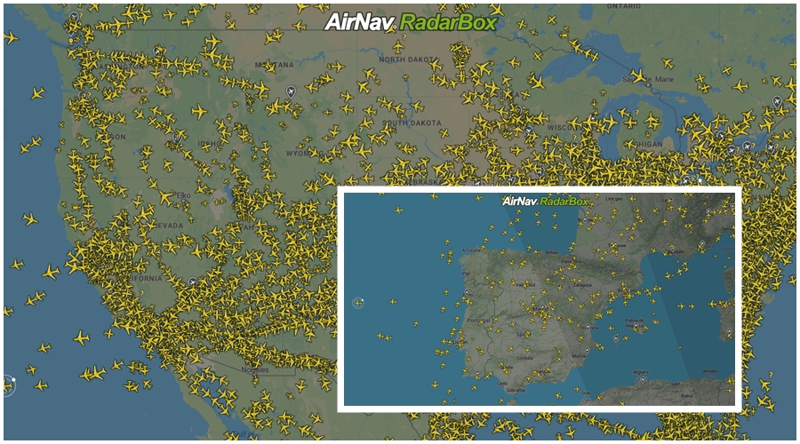
The Image Above: RadarBox Terrain and Classic (Flat) Map Options
RadarBox currently offers 7 different map options that aim to provide our users with the freedom of customizing their map views. In this post, we'll highlight 2 available map options: Terrain and Classic (flat).
The 7 Map Options Available are:
- Terrain
- Classic (Flat)
- Sky Vector VFR
- Sky Vector LO
- Sky Vector Hi
- Satellite Map
- Dark Map
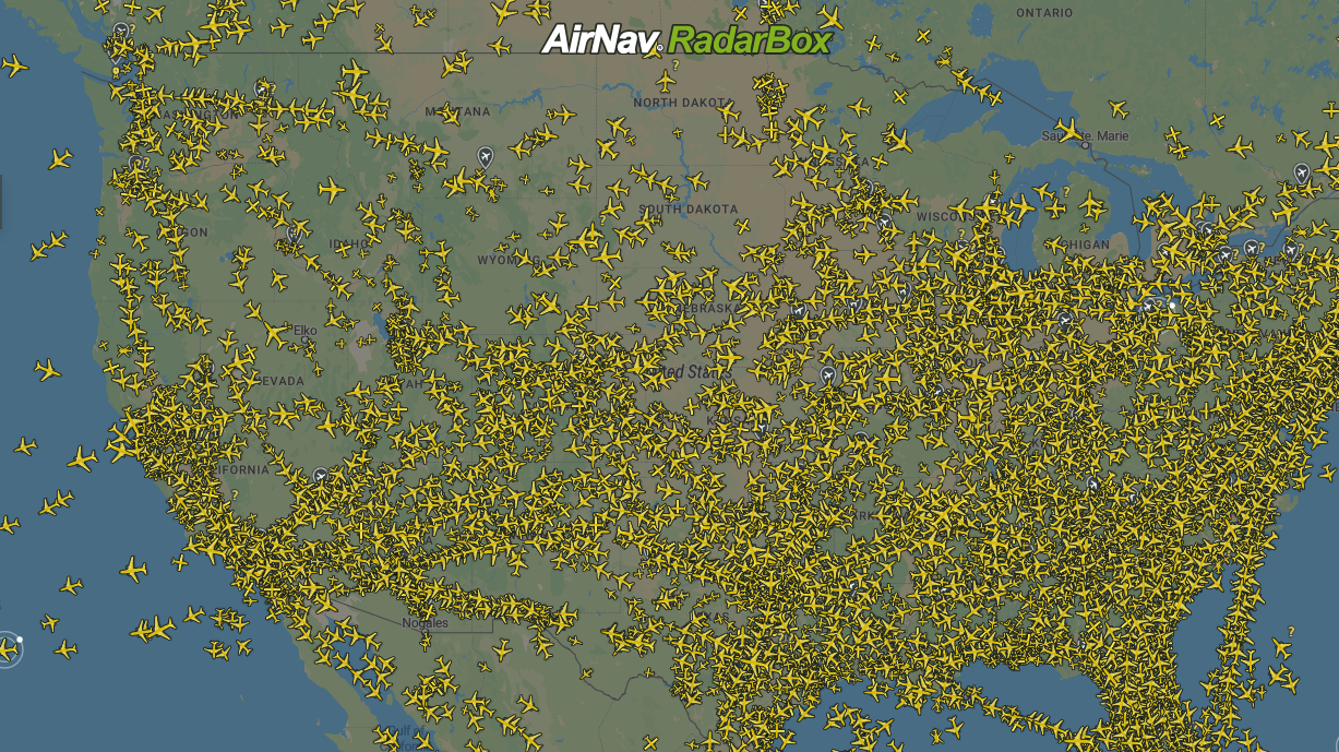
Terrain
Terrain maps are a style of maps that show elevation features such as contour lines. Contours allow you to see the height and shape of mountains and the steepness of slopes.
The Image Above: RadarBox Terrain Map Option
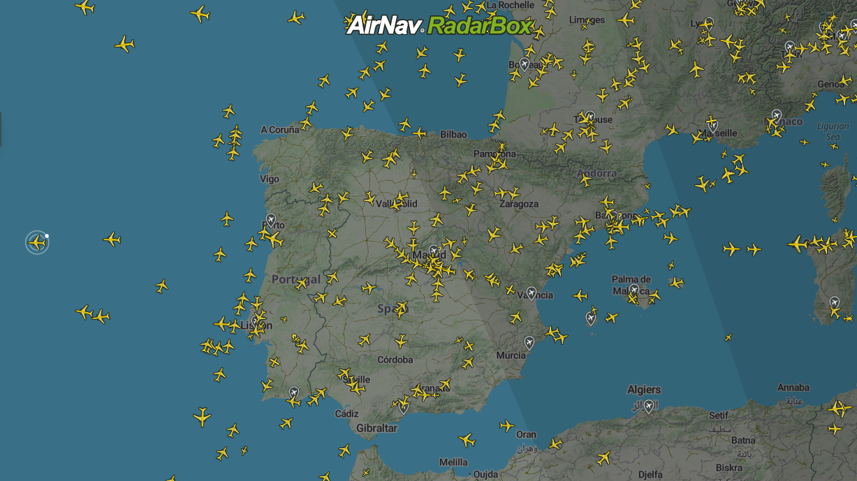
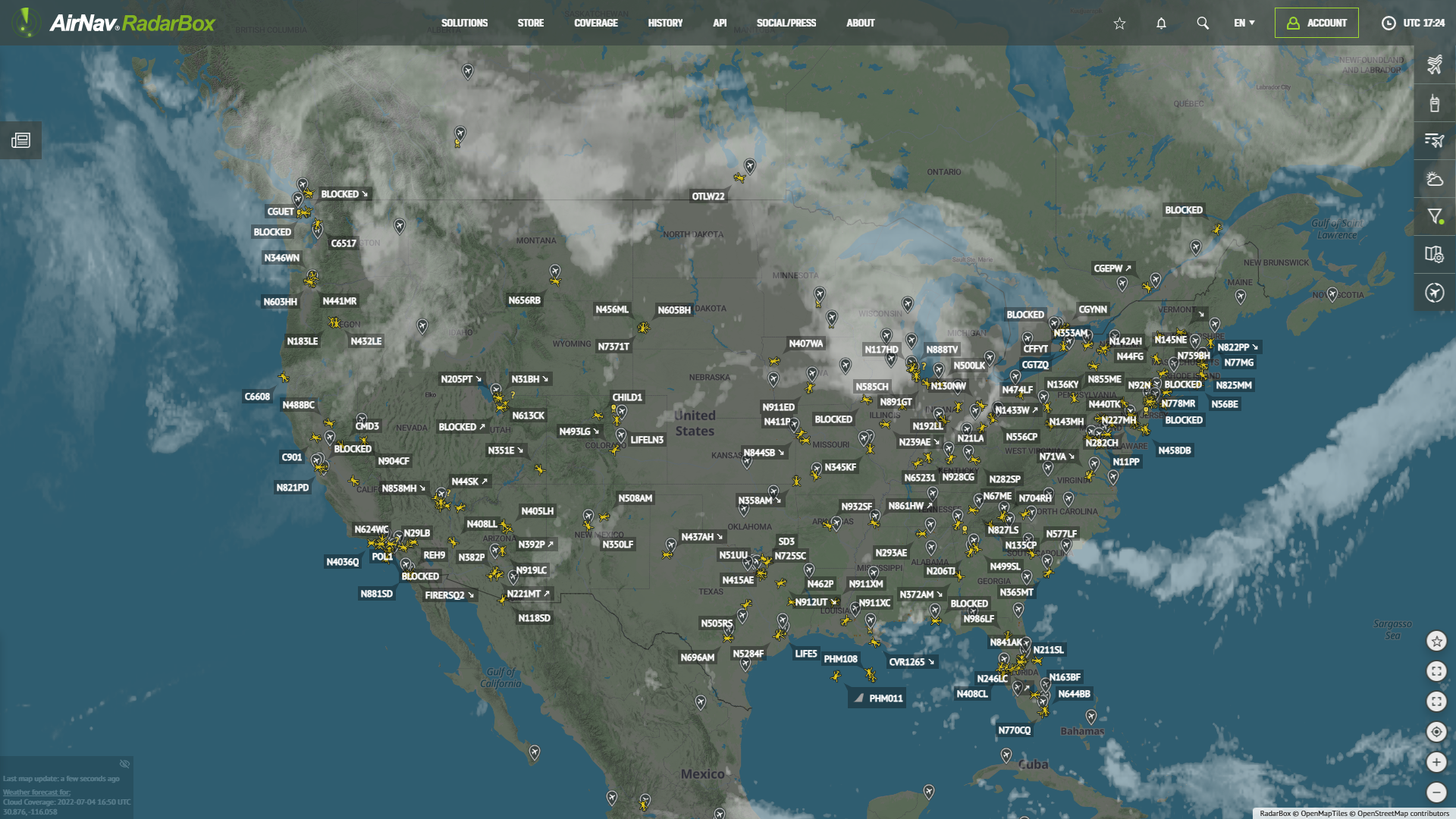
Classic (Flat)
This map option displays a color representation of the world map with detailed geographical features, city and country names, road and highway routes, etc. However, these maps lack elevation information.
The Image Above: RadarBox Classic Map Option
How to choose map options on RadarBox.com
First, log into RadarBox.com, then click on the right sidebar and under "Map Options," and select the map you want to be displayed.
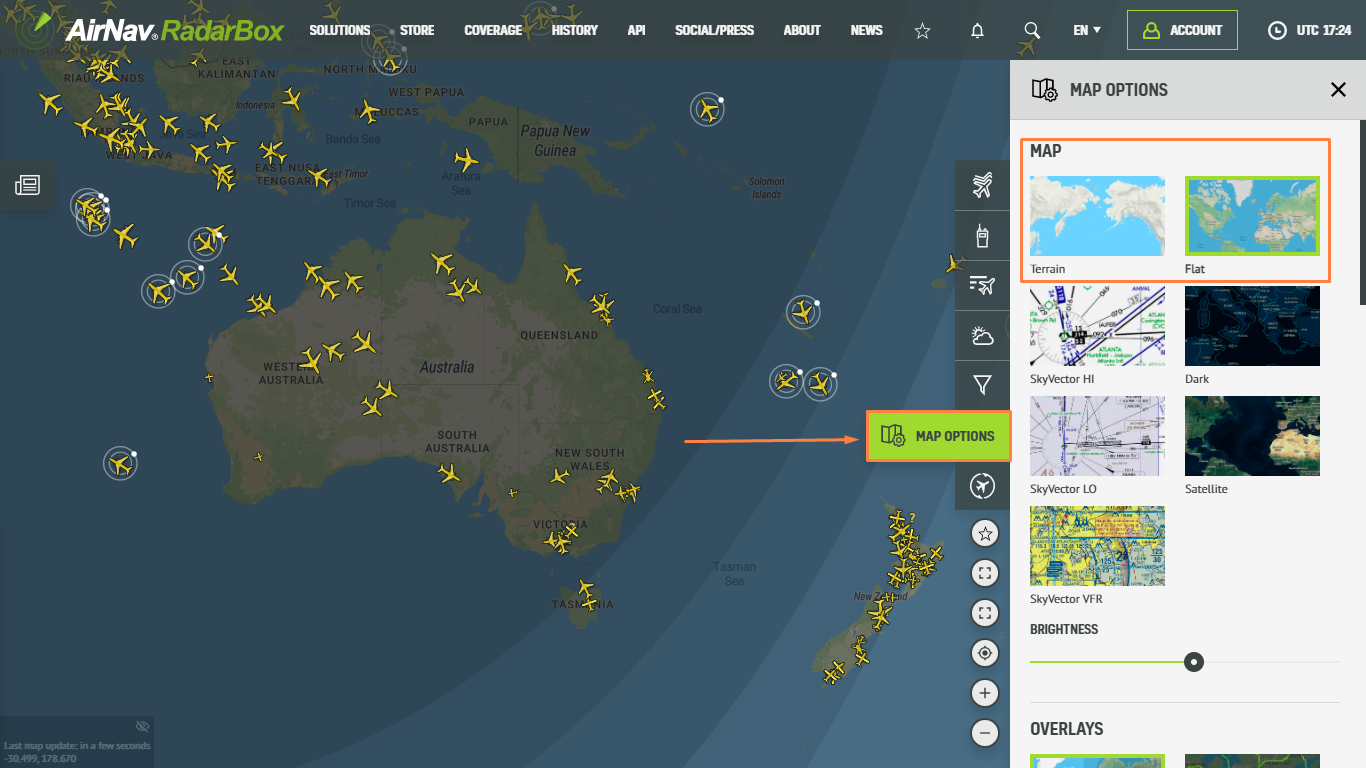
The Image Above: Map Options Tutorial
RadarBox Apps (iOS and Android)
On our RadarBox apps, we currently offer 8 map options: Classic, terrain, dark, hybrid, satellite, SkyVector Hi, SkyVector LO, and SkyVector VFR. Simply choose the map option and select the desired map (see screenshots below).
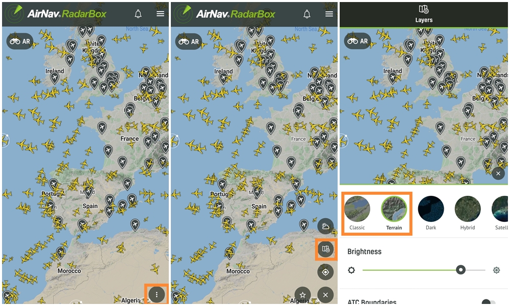
The Image Above: Map options tutorial for apps
To enjoy these benefits, why not consider subscribing to our plans? Subscribe here!
Download our apps now:
![]()
![]()
READ NEXT...
 76350
76350Tracking Helicopters With RadarBox
Today we'll explore how to filter and track helicopters on RadarBox.com. Read this blog post to learn more...- 30210
AirNav Announces Coronavirus Related Data & Graphics Available
AirNav Systems is providing data COVID-19 air traffic related data for analysis, study and use. 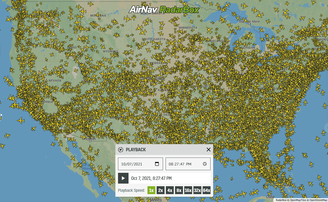 21253
21253Replay Past Flights with Playback
AirNav RadarBox officially launches the playback function on RadarBox.com, allowing users to replay the air traffic for a specific date and time in the past, within a 365-day period. Read our blog post to learn more about this feature.